

Online Tour of the scene of the Battle of Fayetteville in Fayetteville, Arkansas.
The site of the Battle of Fayetteville is now an urban landscape in the booming Northwest Arkansas corridor. Despite the
rapid growth of the city and region, however, it is still possible to trace the troop movements and see the areas where key
fighting took place.
rapid growth of the city and region, however, it is still possible to trace the troop movements and see the areas where key
fighting took place.
| The Fayetteville Confederate Cemetery overlooks much of the battlefield. The ravine through which the Confederates advanced is clearly visible here as the valley separating the cemetery from downtown. |
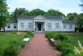
| Headquarters House in Fayetteville, now a museum, was built in around 1858 and served as the headquarters for Union forces during the battle. It stands on East Dickson Street. |
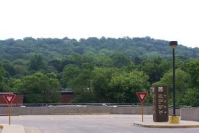
| This is a view of the East Mountain, now called Mount Sequoyah, taken from near the intersection of Dickson Street and College Avenue. Southern troops formed along the lower slope of this ridge. |
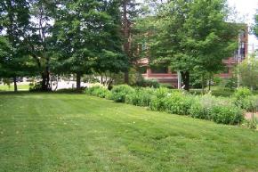
| This is a view of the front lawn of the Headquarters House and shows the battlefield from the perspective of the Union center. Monroe's charge came from left to right along Dickson (visible just beyond the trees). |
ExploreSouthernHistory.com - The Battle of Fayetteville, Arkansas
ExploreSouthernHistory.com - The Battle of Fayetteville, Arkansas
The Battle of Fayetteville, Arkansas
| | | | |
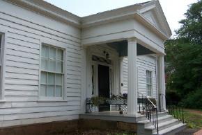
| This is another view of the facade of the Headquarters House. The structure still bears scars inflicted by Confederate bullets during the battle. It stood near the center of the Union line. |
| This is another view of the lawn of the Headquarters House. Monroe's charge was turned back in the street between the lawn and the brick building visible in the background. |
| The Union dead from the Battle of Fayetteville are buried here at Fayetteville National Cemetery. The cemetery also contains the graves of Union soldiers killed at Pea Ridge, Prairie Grove and other engagements in the area. |
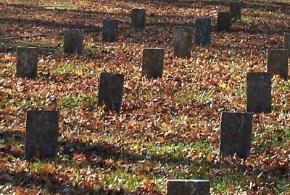
| Southern soldiers killed at Fayetteville are buried overlooking the battlefield in the Confederate Cemetery. The beautiful mountainside burial ground protects a number of graves and also offers a panoramic view of the site of the battle. |


Custom Search
| Copyright 2011 by Dale Cox All rights reserved. |