The Battle of Devil's Backbone, Arkansas
Devil's Backbone Battlefield - Greenwood, Arkansas
Much of the scene of the Battle of Devil's Backbone remains on private property, but some areas are accessible to the
public. This tour gives you a chance to see sections of the field you might not normally be able to visit. These photographs
were taken with the permission of the property owners. If you visit the field, please respect private property rights.
public. This tour gives you a chance to see sections of the field you might not normally be able to visit. These photographs
were taken with the permission of the property owners. If you visit the field, please respect private property rights.
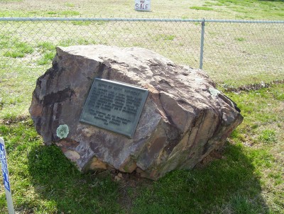
| The U.D.C. monument to the Battle of Devil's Backbone is on the west shoulder of Highway 71 south of Greenwood at the base of the ridge. |
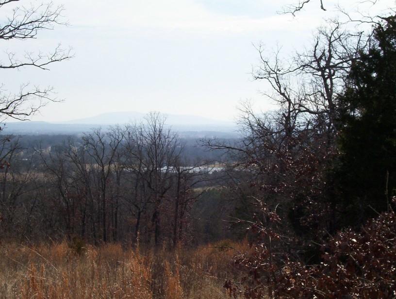
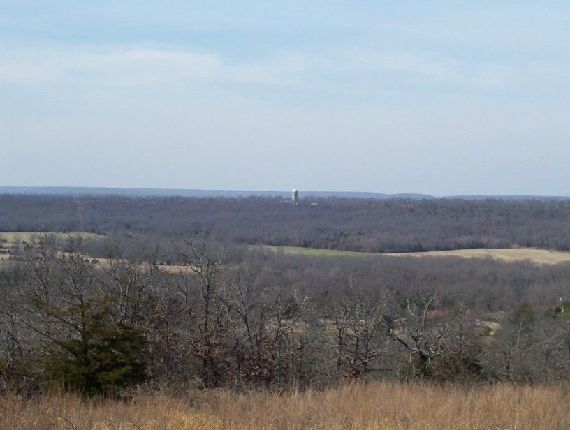
| A view from the top of Devil's Backbone, overlooking the route by which the Federal troops approached the battlefield and scene where they were ambushed. |
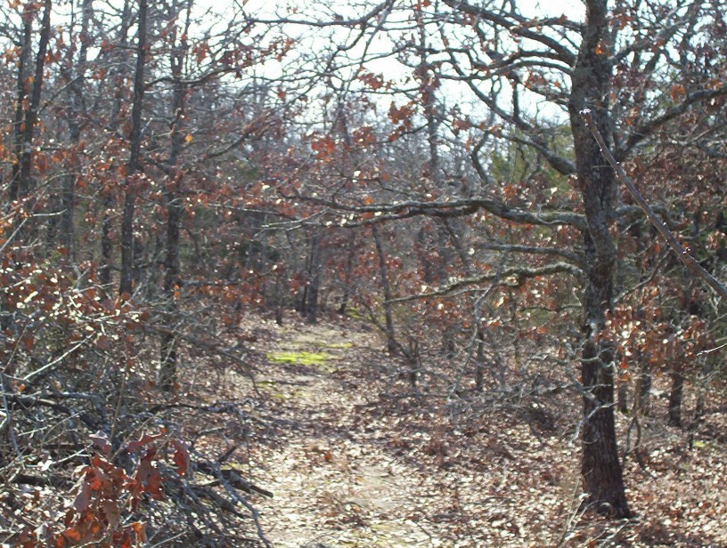
| The trace of the old Jenny Lind to Waldron road is still visible where it leads up and over Devil's Backbone. Confederate infantry deployed to both the right and left ambushed the Second Kansas Cavalry as it advanced straight up the road. |
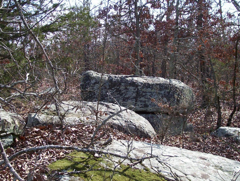
| Boulders along the side of the ridge provided natural breastworks for Cabell's Confederates. Some still bear the impact marks of Federal shells, but much of the Union artillery fire was too high and few casualties resulted. |
Battlefield Tour
| | | | |
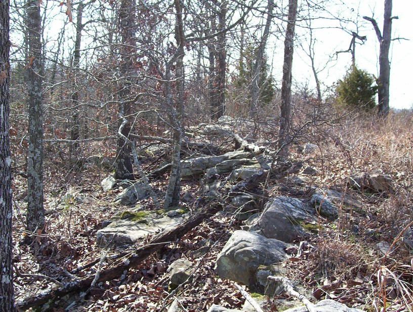
| The natural stony spine of the ridge, from which it takes the name "Devil's Backbone," was augmented by the Confederate defenders who piled additional rocks to form breastworks from which they fired on the Union troops. |
| The Confederate artillery, positioned on a high point of the ridge, commanded a sweeping view of the ground below. The guns, however, were ineffective and appear to have generally overshot the Union attackers. |