
The Battle of Dripping Springs, Arkansas
The Battle of Dripping Springs, Arkansas
The photographs below were all taken from public roadways in the Dripping Springs area. The entire battlefield is privately
owned. If you visit the field, please respect the rights of private property owners in the area. There are no interpretive signs
on the battlefield. To enlarge any of the photographs below, simply click on the image.
owned. If you visit the field, please respect the rights of private property owners in the area. There are no interpretive signs
on the battlefield. To enlarge any of the photographs below, simply click on the image.
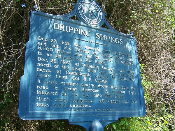

| The historic marker for Dripping Springs is several miles away from the battle site at the intersection of Highways 59 and 220 in Crawford County, Arkansas. |
| The Cove Creek Road leads from near Prairie Grove in Washington County, down through the Boston Mountains to Crawford County. The Union forces advanced along this route. |
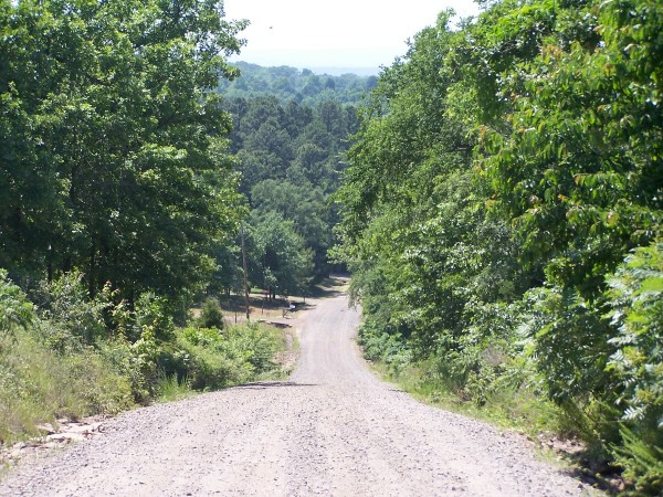
| Dripping Springs Road leads from Highway 220 to the crossroads at Dripping Springs. The crossroads are directly ahead in this photograph. |
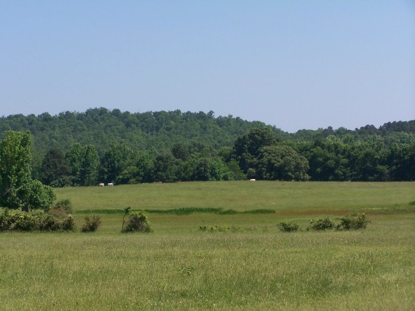
| The Confederates formed in their camp on the slope of the ridge. The Federals advanced against them through the fields. |

Photographic Tour
| | | | |

| This is a view of the Dripping Springs crossroads from the ridge. The highway visible in the left of the photograph is the Old Uniontown Road, which leads to Van Buren. The Union charge broke the Confederate line and they retreated down this road, making several brief stands along the way. |
| This is a view looking from the top of the ridge down the slope in the direction of the crossroads. There is some evidence that the Confederate camp was along the right hand side of the road down the slope from this position. |

Custom Search